
From benches to crosswalks, small interventions can encourage people to walk instead of drive. Some places are simply nicer to walk through than others. Compare a tree-lined path along the Seine inParis to the side of a six-lane highway in Tallahassee, Florida, and the differences are obvious. But what exactly makes a place walkable is a matter of some debate.

Those of the urbanist persuasion might point to a place’s density or mix of land uses. Platforms like Walk Score might favor accessibility, proximity, and travel times. One person might want to have a café within walking distance, while another might want the safety of working streetlights. Conditions are varied, and uneven.
To better understand what exactly makes a place walkable, the architecture firm Perkins Eastman turned to a novel form of data analysis.In a new study, the firm combined qualitative pedestrian preference surveys, visual streetscape imagery from Google Street View, artificial intelligence, and computer vision to identify the specific type and mix of urban design elements that most influence people’s walking habits. Focusing specifically on older adults, the study is a window into the ways cities enable pedestrian activity, and how they can encourage more.

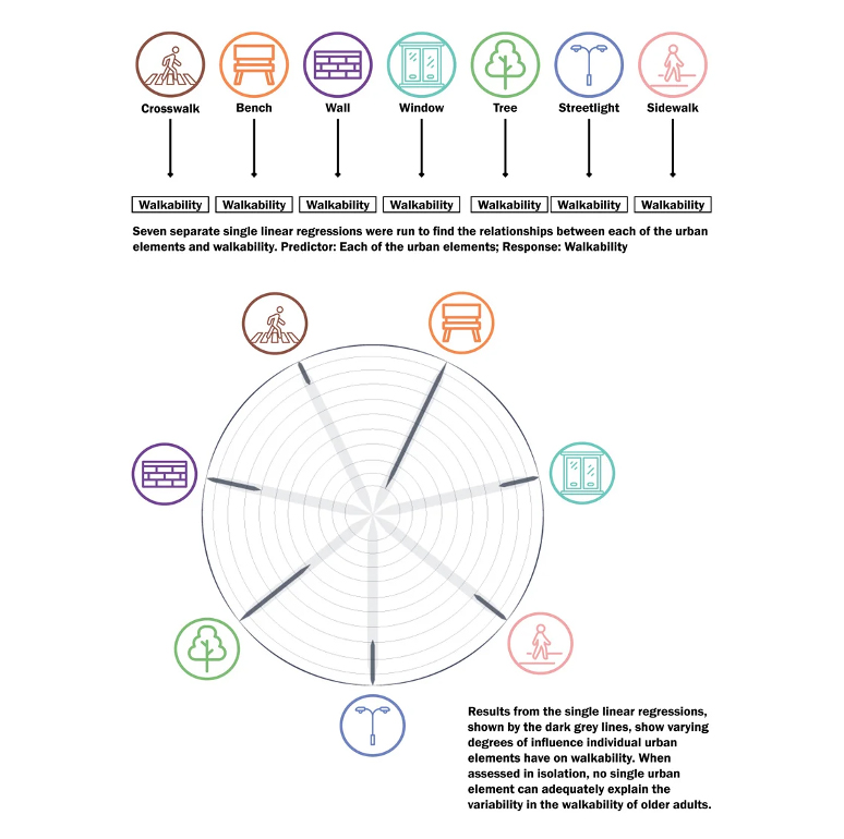
What the walkability study found is that people prefer to walk in places with a higher proportion of several basic streetscape elements, including benches, shade trees, sidewalks, and crosswalks. When those elements are provided in combination with one another—plentiful benches and crosswalks, for example—people are likely to walk even more.
The study was based in the Kowloon district of Hong Kong, where a decennial survey collects detailed information from more than 100,000 pedestrians about the experience of walking through this part of the city. This survey data was analyzed alongside GoogleStreet View imagery of the district to see what streetscape elements were predominant in places people reported being most likely to walk. This analysis led to a set of urban design guidelines that suggest ways of making more spaces more walkable.

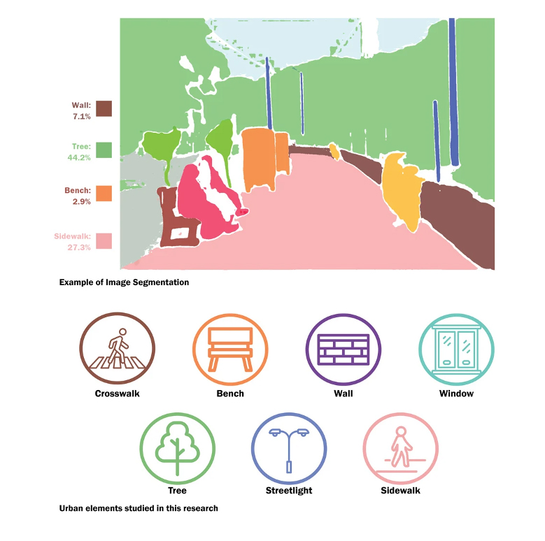
Google Street View offered a deep pool of data about the real world conditions experienced by pedestrians in Hong Kong. His study used 32,512 images from Google Street View, separated throughout the district at 10-meter intervals. Machine learning techniques then broke each image down to identify individual streetscape objects within the frame and how much space they accounted for.

One image might show tree canopy covering roughly half the image and sidewalk making up about a quarter. Other images show benches and walls. Still others highlight cross walks and how much space is dedicated to car traffic. Along with providing some insight into how to make the city a more welcoming place to walk the image findings provided a fresh and somewhat artsy look into city planning.
Read more bout Artificial Intelligence & Machine Learning.

Did you know?
Tacpoint offers Artificial Intelligence & Machine Learning solutions, learn more by talking to one of our AI/ML experts below.


